Projects 9 - ISCouncil

Transport Access Program 3 – Banksia, Birrong, Roseville, Wollstonecraft, Canley Vale Station Upgrades

Key benefits:

Banksia Station

  • Three new lifts to the station platforms; improvements to the existing underpass; new kiss and ride area and accessible parking space on Hattersley Street; upgrades to CCTV, lighting and way-finding signage; modification of the existing station building on Platform 2 and 3 to provide unisex ambulant toilets and a family accessible toilet; regrading sections of the platforms; additional platform canopy coverage on platforms 2,3 and 4.

Birrong Station

  • A new lift connecting the Avalon Street over bridge with the station platform; new stairs to replace the existing Avalon Street over bridge stairs to the station platform; one new accessible parking space on Teresa Street; improved kiss and ride area on Teresa Street; new landscaping at the station entrances; improved amenities such as new new male and female ambulant toilet and an upgraded family accessible toilet; improved CCTV, lighting and way-finding.

Roseville Station

  • Existing footbridge upgraded including new screens and handrails; two new lifts which provide access between the Pacific Highway and the existing footbridge; Canopies at the Hill Street station entrance and the platform boarding assistance zone; An interchange zone including accessible parking, taxi zone, kiss and ride bay, bus shelter and increased bike parking on Hill Street and Pacific Highway; Improved amenities including a male and female ambulant toilet and family accessible toilet; Improved CCTV and lighting.

Wollstonecraft Station

  • Two new lifts connecting to the station platforms; new station entry ramps from Shirley Road and Telopea Street to provide accessible paths to the lifts; platform raising wok to bring platforms level with train carriages; a covered boarding assistance zone on Platform 1; a new accessible parking space on Shirley Road; improved amenities such as a new male and female ambulant toilet and a new family accessible toilet; improved CCTV and lighting.

Canley Vale Station

  • Two new lifts from the existing footbridge to the station platforms; new accessible parking space and kiss and ride on First Avenue; one family accessible toilet and two ambulant toilets; upgraded station entrance and widened footpath on Railway Parade; regrading sections of the platforms; improvements to lighting, way-finding and CCTV.

TAP3 projects strive to achieve maximum social, economic and environmental outcomes and value for money. The approach to embedding sustainability on the TAP 3 program is to look at the main activities of the program and identify sustainability opportunities and outcomes.

While the scope of the TAP 3 program will focus on upgrades to meet Disability Standards for Accessible Public Transport (DSAPT) requirements, the upgrades may also facilitate the use of public transport by:

    • Enabling more people to transfer from using private vehicles to public transport by making stations more accessible;
    • Designing interchanges to enable people to access stations by sustainable and healthy modes such as walking and cycling and by bus;
    • Providing accessible parking at stations to enable trains to be used for most of the journey instead of driving the whole journey.

Project Details

  • Rating Type:Rail
  • Registered Date: 05.06.2020
  • State:NSW
  • Suburbs: Banksia, Birrong, Roseville, Wollstonecraft, Canley Vale
  • Assessor: Gareth O’Brien
  • Other Key Stakeholders: Transport for NSW, Downer


To find out more information about this project,
visit the Transport for NSW website:

https://www.transport.nsw.gov.au/projects/transport-access-program


SH29 Tauriko Enabling Works

Description

The Tauriko Enabling Works will improve safety at intersections of SH29 with Redwood Lane, Belk Road and Cambridge Road, enable development of up to 2400 homes within Tauriko West, support expansion of Tauriko Business Estate, protect the freight route to the Port, improve journey reliability and access to public transport, walking and cycling.

Rating Highlights

Category Credit Achievements/ Description
Stakeholders Sta-2 Level 3 verified for Sta-2 Level of engagement – The hapū partners collaborated on some of the key aspects of the project including the preferred solution for the noise wall and various cultural artworks. This reflects the desire of the 3 hapū to maintain or revive wetlands, enhance waterways and culturally significant landform legibility to preserve and protect them. The constructed wetlands and landscape planting within the natural wetlands as part of this project will contribute to positive sustainable outcomes using nature-based solutions. The natural wetlands also influenced the alignment of the road.
Procurement Pro-2 NZTA’s Broader Outcomes procurement strategy aligns with the credit’s objective to show a publicly stated commitment to require sustainability aspects to be considered in the procurement process, and the commitments were embedded into the project’s sustainability objectives.
The design for the SH29 Tauriko Enabling Works project is the first commended Infrastructure Sustainability (IS) Council rating NZ Transport Agency has achieved under its Sustainability Rating Scheme Policy for the design phase. This is NZ Transport Agency’s first verified IS rating, under its Sustainability Rating Scheme Policy.


Certified Date

14/6/2024


Leppington & Edmondson Park Commuter Car Parks

  • Rating Type: Car park
  • Certification Date: 26th of May 2022
  • Practical Completion: Leppington: 18th Oct 2021, Edmondson Park South: 24th January 2022
  • State: NSW
  • Suburb: Leppington, 2179 & Edmondson Park , 7147

Project Overview

The Commuter Car Parks Program is an initiative of the NSW Government to increase the provision of parking at key locations throughout Greater Sydney. Transport for NSW is responsible for delivering 4000 new commuter spaces at 13 locations. This project covers the development of two carparks, situated at Leppington and Edmondson Park South, located in South-West Sydney.
The Leppington and Edmondson Park South carparks are five storeys and six storeys respectively and provide commuters with over 1,000 parking spaces each. The roof level of the carpark is covered with steel roofing to support solar panels, which have been sized to cover the whole roof. Electric vehicle charging points and additional infrastructure for future charging points have been provided throughout the carpark.
The two carparks have very similar structure and have achieved a joint Infrastructure Sustainability (IS) ‘Excellent’ Design rating.

Project Description

Carbon positive car park:

The Leppington and Edmondson Park South car parks have reduced the energy related emissions by 153% against a reference building through the following initiatives:

  • The use of highly efficient LED lighting with motion detection and daylight sensors for each fitting, significantly reducing operational lighting demand
  • A combined 1,370 kWp rooftop solar PV across both car parks, projected to produce at least 130% above annual operational energy requirements

The sizing of the rooftop PV system was informed by a detailed Whole of Life Cost analysis which included an analysis on PV sizing options, EV charging technology and the integration of battery energy storage. Following the outcome of the study, it was decided that the PV system was to be maximised for both carparks, providing the most benefits from the available roof space.

Promotion of local heritage values at Leppington Car Park:

During the design phase of Leppington and Edmondson Park South Car Parks, ongoing engagement and consultation with the Tharawal Local Aboriginal Land Council took place to explore collaboration opportunities. This developed into an Aboriginal led co-design process for the façades at both Leppington and Edmondson Park South, with future opportunities also identified around landscaping, and a story board interpreting local Aboriginal heritage and context to the designs.

Indigenous participation in design was conceptualised by Aboriginal Architect Michael Hromek-Yuin,(Badawang) and managed by Josh Loyd (Wajarri Yamatji), providing Indigenous led and managed participation throughout the design process.

Aboriginal artist Shane Smithers (Darug, Burraberongal) was engaged to assist with design and interpretation of artwork, and his artwork ‘Where Sky Meets Earth”’ which has been incorporated into the façade at Leppington Car Park, embedding cultural values and principles into the development. In this artwork, Shane has horizontal lines which represent Mother Earth, and vertical lines which represent Father Sky. The art piece reflects that Darug Country is a place where sky meets earth, and where the generative forces of Wiari (Mother earth) and Biari (Father Sky) come together to create all life.

For the Edmondson Park South facade, Shane produced a new artwork titled ‘Ghost Trees and The Lost Woodland’, which focuses on the destruction and degradation of the native Cumberland Plain Woodlands. The north, south and western façades show a pixilated form of the woodlands, resembling the remaining isolated trees and acknowledging the loss experienced. The east façade shows a detailed representation of the woodlands amongst an urban backdrop of houses and rooflines to provide hope for urban regeneration. The image details the tree roots in the soils and tree canopy in the sky, sharing Indigenous knowledge and connection to mother earth and father sky. This connection represents the coming together of the forces of birth, rebirth and regeneration.

Sustainable construction materials and design practises:

A number of initiatives to reduce the material impact of the carparks were undertaken, including:

  • An average of 40% supplementary cementitious material (SCM) replacement in concrete mixes targeted across the concrete used in the project
  • Optimising the column spacing and therefore reducing the overall number of columns required to provide structural support to the upper levels.
  • Use of post-tensioned slabs with reduction of steel reinforcement used
  • Rearrangement of band beam orientation to East-West direction, reducing overall band beam length and number of columns
  • Optimising the foundation design, adopting larger piles and founding on rock with more skin friction. This has resulted in a 50% reduction in piles and the deletion of pile caps
  • Deletion of concrete upstand, replaced with proprietary steel crash barriers providing the following benefits:
    • Reduction in overall building weight and concrete footings
    • Enabling slab to act as cantilever, removing the need for external columns
  • Smaller stair cores with a reduction in concrete walls
  • Re-use of the existing ground slab sub-grade at Edmondson Park South Car Park

Furthermore, the Leppington and Edmondson Park South carparks were designed for adaptability and disassembly to consider the whole of life material use. The following design initiatives were implemented to consider future carpark uses:

  • Adaptable use of the ground floor through
    • An increased ground floor height from a typical 3m to 4.5-6m to enable future conversion into commercial space or other community use. Ramps accessing the upper levels have been provided to maintain access to the carpark while the ground floor is utilised for other purposes
    • Provision of hydraulic services on the ground floor so that future spaces can be easily created without the need to demolish existing structures.
  • The carpark structure has been designed to account for further levels in case there is a need for more car parking space in the future.
  • The roof and solar panels have been designed to allow for detachment and reattachment if the carpark was to be expanded by two more levels.

For the Mat-1 credit, the material savings from SCM replacement in concrete were quantified and resulted in an 18% reduction in the material impacts across the construction and operation of the car parks alone.

Project Website

Edmondson Park Commuter Car Park | Transport for NSW

TfNSW CCPP Edmondson Park South Commuter Car Park | A W Edwards

City Rail Link – Enabling Works Contract 1

Project Description

This project achieved a ‘Leading’ As Built IS Rating.

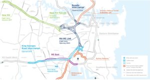
Linking the existing dead-end Britomart Station in downtown Auckland with the Western Line 3.45 kilometres away at Mt Eden and building two new train stations at Aotea and Karangahape will make the city’s electrified rail network more efficient, providing a world standard rail network to reduce Auckland’s reliance on cars.

The CRL project aims to achieve sustainability excellence by being careful with the resources we use, optimising our carbon footprint, avoiding waste and leaving a positive social and cultural legacy for Tāmaki Makaurau. The CRL project’s partnership with our Mana Whenua Forum, which consists of representatives from eight different iwi, has ensured that their invaluable contribution of Māori mātauranga benefits the project and challenges us to work harder towards supporting the principles of kaitiakitanga. DSBJV began construction on Contract 1 in 2016 with works completed in October 2021.

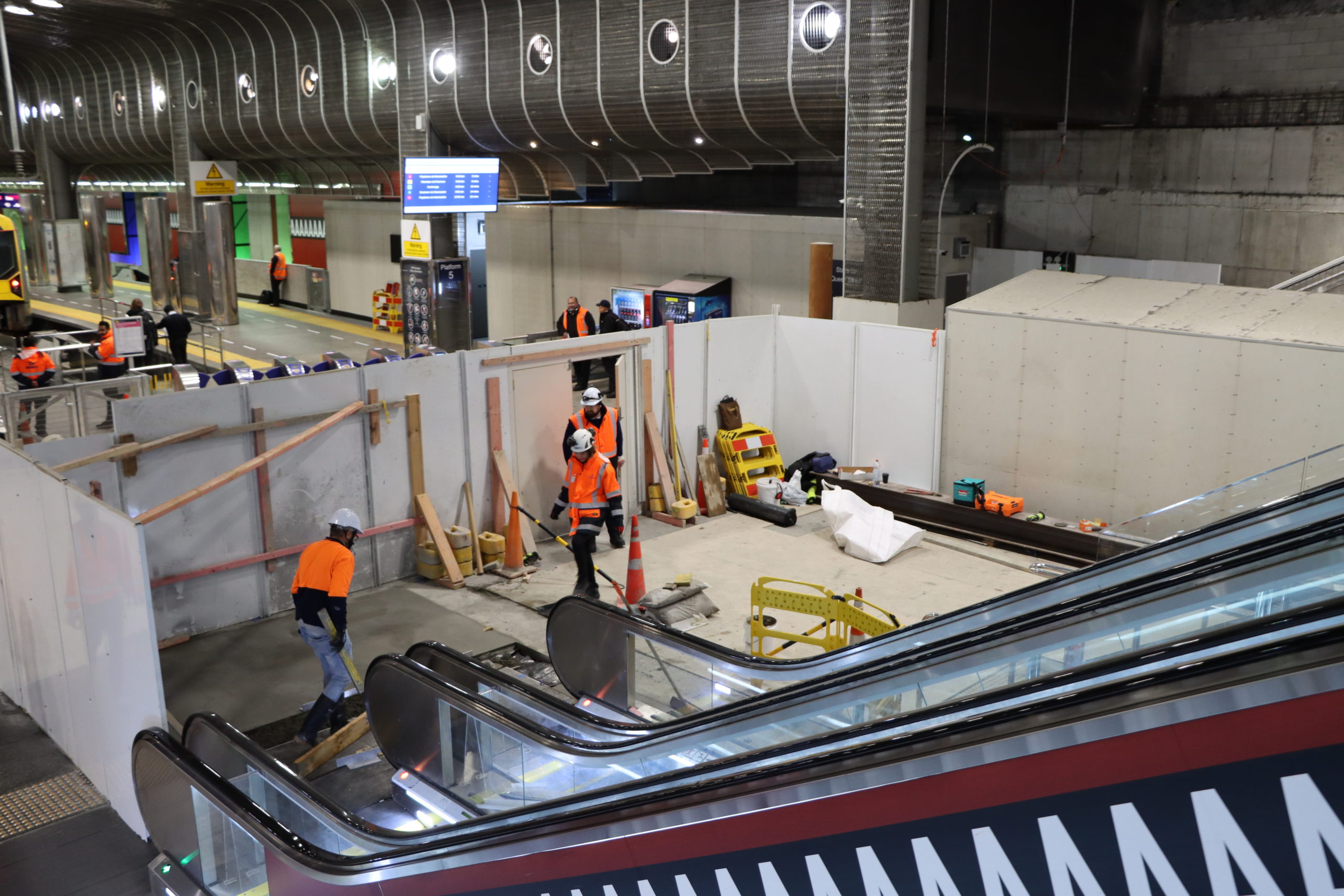
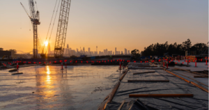
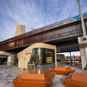
Contract 1 included works in Britomart Station (west of the existing gate line) to change from a terminating to a through-station, the construction of twin 136m tunnels under the Chief Post Office (in which the station is housed) and Lower Queen St, and the reinstatement of the surrounding urban realm. This included a new public square – Te Komititanga, designed by mana whenua artists and weavers. This contract excluded trackwork and rail systems.

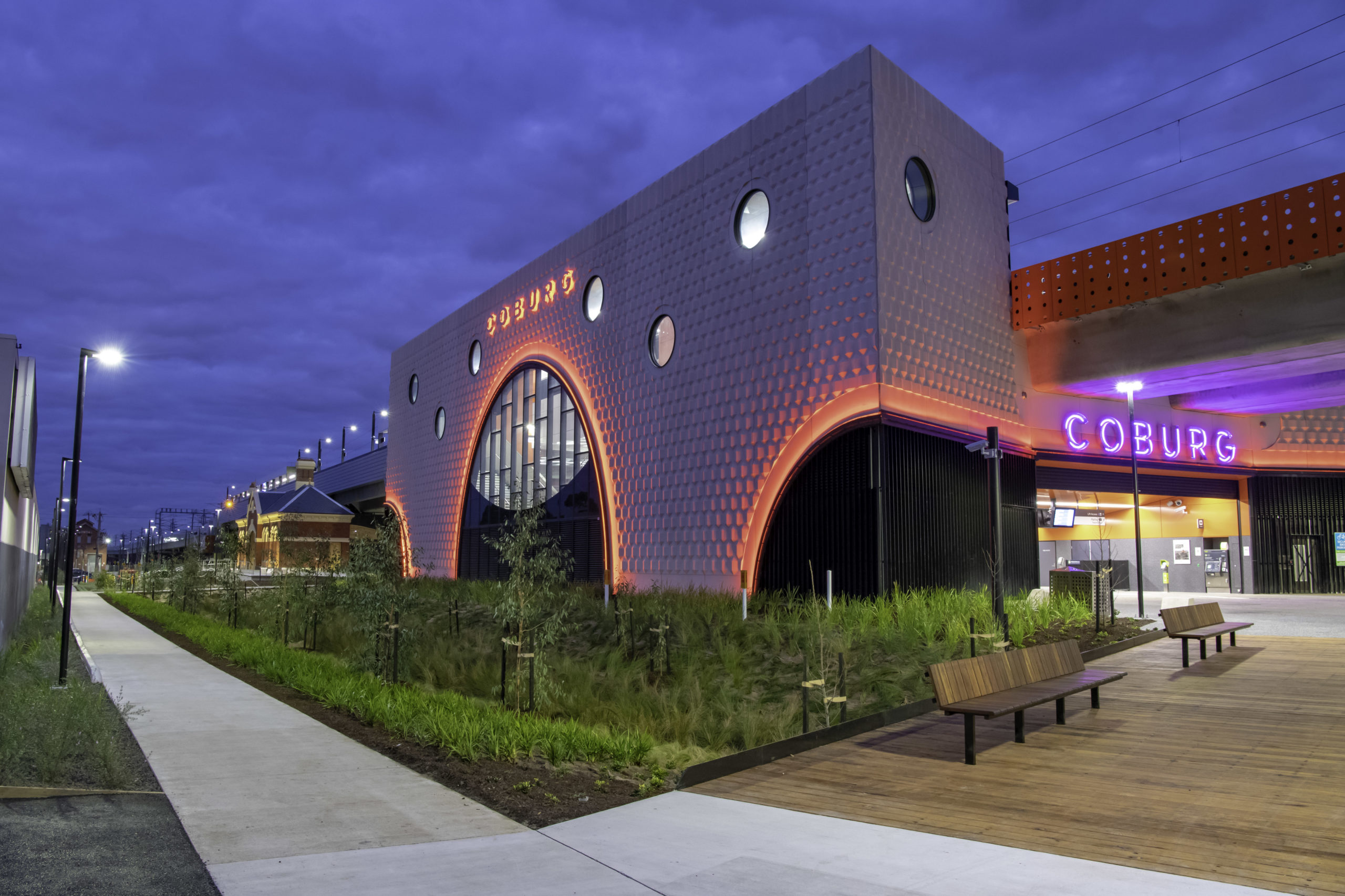
Britomart station, the busiest on the network, is in the heart of Auckland’s CBD and housed in the historic and protected Chief Post Office building. This masonry building was underpinned to allow the tunnels to be built underneath, and the station remained operational throughout. The work was undertaken in close proximity to offices and residential buildings, some of which also have heritage status, and so the designation conditions set strict criteria around noise and vibration limits.

From the outset CRL Ltd was determined to deliver an exemplar project – using the scale and complexity of the country’s largest transport infrastructure enterprise to push the benchmark higher for construction, workplace safety, environmental sustainability, and to reach into the community with targeted training and employment opportunities for those typically disadvantaged in the workplace.

Key Achievement

This project is a critical step in doubling the rail capacity of Tāmaki Makarau, Auckland. Through a vast number of initiatives to raise the project’s environmental and social performance the contract targeted and achieved ‘Leading’ design and as-built IS ratings.

Resource efficiency was central with over 97% of construction and demolition waste and 100% of spoil diverted from landfill. Over the projects 100-year lifespan measures taken to improve efficiency through design and construction will result in:

  • 17.8 per cent reduction in peak operational energy use
  • 23 per cent reduction in operational carbon emissions and
  • 58 per cent reduction in operational water use

Through partnership with our Mana Whenua Forum, nominated designers have brought to life cultural narratives in the urban realm, with the creation of Te Komititanga. Participation in CRL Ltd’s Progressive Employment Programme pilot, provided opportunities for Māori and Pasifika youth to gain experience across construction sector roles.

Project Highlights

Highlight 1

Level 3 verified for Man-6 Reporting and Review and Man-7 Knowledge Sharing Results:

  • CRL Ltd has issued annual sustainability reports detailing performance on the Infrastructure Sustainability Rating, zero waste to landfill, calculating a carbon footprint and materials monitoring, social outcomes achieved, and engagement with Mana Whenua.
  • Leaving a legacy was a cornerstone of sustainability thinking for this contract. With a strong focus on knowledge sharing designed to extend beyond the life of the project through initiatives which support development of the sustainability capacity and capability of the sector.

Achieved through:

  • Well defined and integrated sustainability management system with regular reviews and reporting to sponsors, CRL Ltd and DSBJV Boards, Senior Leadership Teams, Mana Whenua Forum and the Community Liaison Group.
  • The CRL Infrastructure Sustainability Management Plan and Sustainability Communications Framework provided for sharing sustainability knowledge by both CRL Ltd and the contractor, both within the project team and wider – with AT, external stakeholders and general public. Initiatives included: an internal knowledge sharing database; public website on sustainability aspects; CRL sustainability forums; conference papers and presentations.

Highlight 2

Waste Management Level 3 verified for Was-2 Diversion from Landfill.

Results:

  • 100% of spoil diverted from landfill.
  • 97% of construction and demolition waste diverted – keeping 8,303t out of landfill.
  • 74% office waste – 24t diverted from landfill.

Achieved by:

  • A project target of zero waste-to-landfill.
  • Avoiding/reducing waste through procurement and design optimisation.
  • Teams committed to reducing waste generated on and off site.
  • Onsite separation of concrete, steel, clean fill, office waste, compost.
  • Offsite sorting by Green Gorilla of the remaining construction waste.

Reusing waste materials on and off site including:

  • Timber framing reused for formwork.
  • Polystyrene reused as: swimming pool fill, house, garage and barn. insulation, for retaining walls, surfboards, and model making fill.
  • Fixtures and fittings sent to community recycling centres.
  • Interblocks and kerbstones salvaged and reused.
  • Timber hoardings reused.
  • A coffee kiosk disassembled and relocated to Owairaka Community Garden.

Highlight 3 

Energy Level 3 verified for Ene-1 Energy and carbon monitoring and reduction and Ene-2 Opportunities

Results:

  • Modelling shows a 23% reduction in Scope 1, 2 and 3 emissions over the infrastructure’s 100-year life cycle.

Construction energy efficiencies were achieved through:

  • A change in construction methodology from using contiguous piles in pre-treated columns to diaphragm walls and mini piles underneath the Chief Post Office (CPO) buildings.
  • The replacement of diesel generators with grid electricity for site offices and on-sire equipment.

Operational energy efficiencies were achieved through initiatives that will reduce emissions (in order of importance):

  • Station plant efficiency.
  • Removal of radiant heating in the station.
  • Energy saving modes added to the escalators.
  • Motion and daylight sensors for the station lighting.
  • Switching from diesel generators to grid electricity during construction (saving close to 35,000 litres of diesel – an 85% reduction in emissions).
  • Changes to piling methodology.

Highlight 4  Water & Receiving Water Quality

Level 3 verified for Wat-1 Water use monitoring and reduction, Dis-1 Receiving Water Quality, and Level 2 for Wat-2 Water saving opportunities.

Results:

  • A Water Treatment Plan reduced construction water consumption by 21%.
  • An estimated 58% reduction in water use over the lifecycle of the station (including construction and 100-year operational lifespan).
  • A 13% saving is projected for the urban realm during the 100-year design life of the station.

Achieved by:

  • Modelling all significant water uses, auditing existing water use at the Britomart station and back casting savings from water saving initiatives.
  • Monitoring actual water usage during construction.
  • Use of a water treatment plant and other mitigation measures as part of a water quality monitoring programme to support receiving water quality.

Initiatives to reduce water use during construction included changes to construction methodology:

  • From secant piles to diaphragm walls underneath the Central Post Office (CPO) building, reducing the amount of water needed for the piling rig.
  • From bored piles and jet grouting to secant piles in Lower Queen Street, reducing the jet-grouting water requirements.
  • Introduction of water-efficient fittings, including toilets and urinals, in the re-developed station.
  • Installation of more drought resistant native tree species in the public realm with moisture probes that reduce the need for watering.

Highlight 5 Heritage

Level 3 verified Her-1 Heritage assessment and management and Her-2 Monitoring

Results:

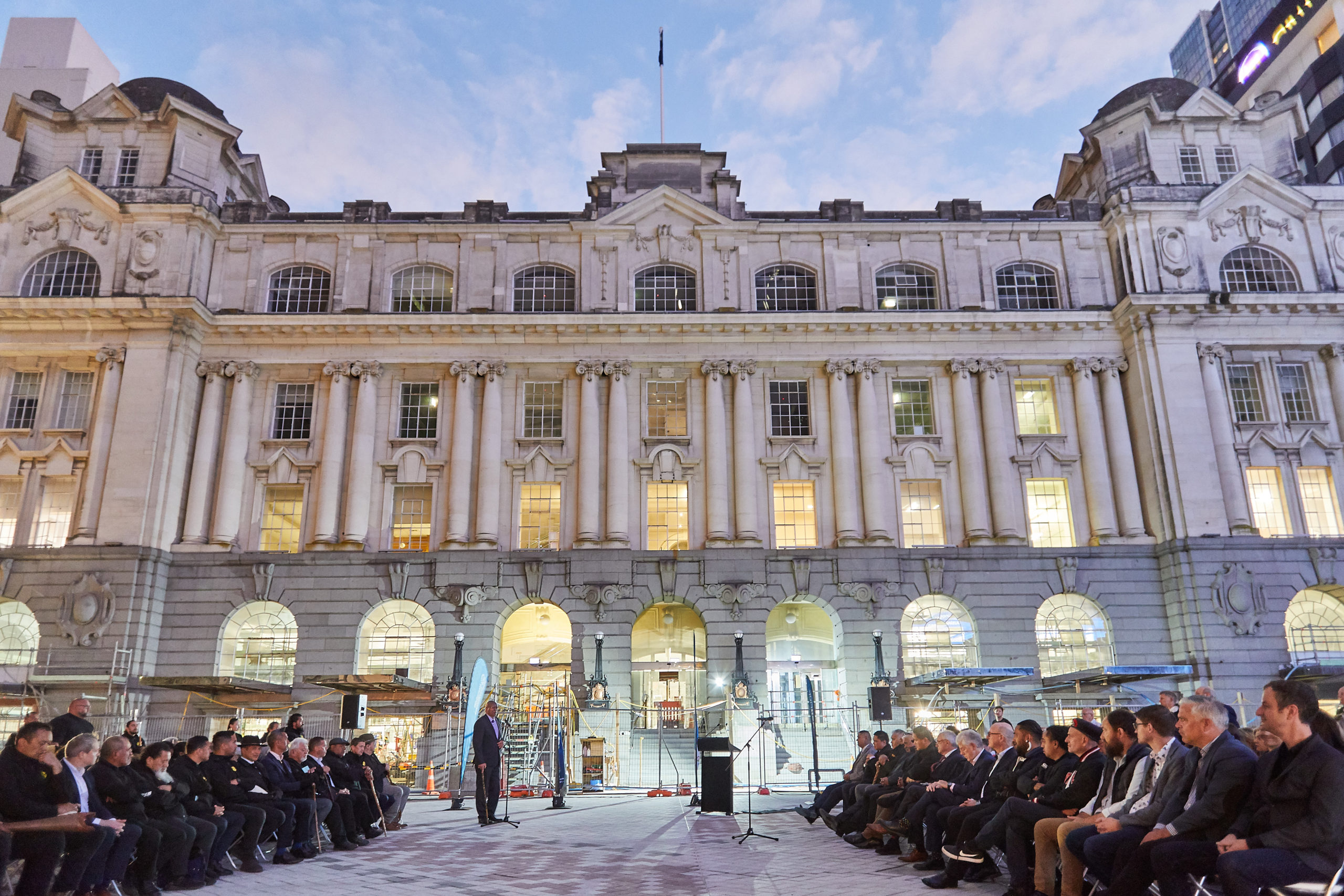
  • The Chief Post Office (CPO), designed in 1909 in Edwardian Baroque style, is a listed heritage building of regional and national significance. Despite the challenge of building tunnels directly below the existing fabric of the building was maintained and all spaces redeveloped in accordance with conservation principles.
  • A key aspiration was to keep the integrity of the historical character intact, with a design that felt as if it touched the existing fabric only lightly, despite the radical changes that were happening due to the excavation of tunnels through the building.
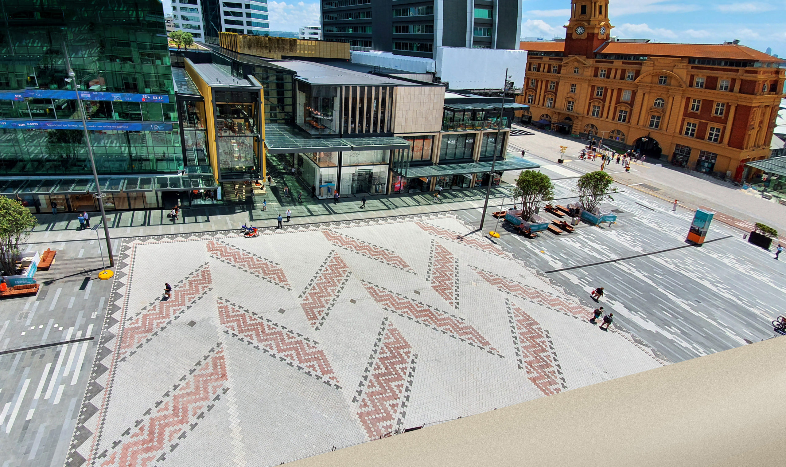
  • Mana Whenua cultural narratives are prominently embedded within the design of Auckland’s newest premier civic space – Te Komititanga – immediately outside the CPO, which features 137000 basalt pavers in a pattern design. Created by Mana Whenua artists and weavers, Mana Whenua gifted the name Te Komititanga meaning ‘to mix’ or ‘to merge’ in Te Reo Māori. Two bodies of water -Wai Horotiu, the stream that once ran down Queen Street, and the Waitematā Harbour are referenced. It also alludes to the mixing or merging of people as they commute through the city using the nearby train, ferry and bus services.

Achieved by:

  • Completion of detailed heritage assessments, including a baseline survey.
  • Careful removal, labelling, storage and restoration of sensitive heritage features.
  • Monitoring the building in real time, during the foundation load transfer, to ensure the building remained precisely within the 3mm lift limit.
  • Continuous monitoring sensors installed throughout the building ensured the structural integrity of the building was maintained.
  • Artefacts and relics unearthed within the site’s relatively small construction footprint included remnants from the city’s history were carefully catalogued and many will be displayed at the renovated station.
  • Remains of the first Queen Street Wharf, built in the 1800s were also discovered and because the wharf’s timber was in surprisingly good condition, some was used as timber finishes in the renovated station.
  • As part of the Cultural Values Assessment, CRL Ltd’s Mana Whenua Forum has undertaken hikoi (site visits) and been directly involved in design as project partners.

Stakeholder Engagement Level 3 verification for Sta-1 Stakeholder engagement strategy and Sta-2 Level of engagement.

Results:

  • Comprehensive stakeholder engagement strategy.
  • High levels of stakeholder engagement.

Achieved by:

  • Consulting with stakeholders via open days, newsletters, CRL Design Roadshows (13 suburbs through Auckland), one-on-one meetings, presentations and the website as per the Construction Communication Consultation Plan (CCCP). Specific issues are highlighted on the website and during open days.
  • Involving the local community in the design of the environmental management plans. Draft plans were written and provided to a community liaison group (CLG) to review as residents and businesses in the area. All comments from the community were reviewed and either used to amend the plan or provided with a reason why they were not included in the plans. Negotiable and non-negotiable issues were explained during the CLG meetings.
  • Collaborating with our Mana Whenua Forum. This partnership makes the CRL a unique project by incorporating culture and history in station designs and public space.

Acknowledgements

International Firsts World First Innovation: Embedding cultural values within a sustainability rating framework. Having cross checked this initiative and the inclusion of cultural values against other international rating schemes,i has been confirmed that this is a world first. Mahi Rauora Aratohu – a tailored Infrastructure Sustainability technical manual developed in partnership with our Mana Whenua Forum that responds to the cultural context of Tāmaki Makaurau.

The work undertaken, collaborating with mana whenua to embed Māori cultural values across the IS framework includes the following outcomes:

  • Transformation of a select number of IS credits to address the cultural values of Mana Whenua.
  • Raising the knowledge base of our client team and contractors.
  • Responding to the cultural values of Mana Whenua in the delivery of CRL.

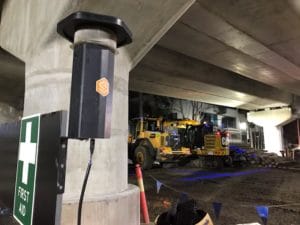
New Zealand Firsts New Zealand First Innovation: Real time noise and vibration monitoring and alert system DSBJV engaged a web-based real time monitoring and alert system for noise and vibration monitoring. This was the first time this technology had been used in New Zealand. Richard Preece, Auckland Council’s Team Leader: Compliance Monitoring Central confirmed the approach was “above and beyond current industry standards.”

This innovation achieved the following outcomes:

  • A marked shift away from reactive, and retrospective, complaint-based noise and vibration monitoring to the use of real time alerts where preset thresholds were exceeded.
  • Allowing a more rapid loop between notification and verification, information was able to be responded to proactively.
  • Allowing more informed and timely engagement with stakeholders.
  • Identification of unexpected exceedance and adaptive management for future occurrences.

Testimonial

“Having the CRL project’s sustainability goals and performance externally validated through ISC has been both challenging and rewarding. Ultimately, it’s meant that we have had clear goal posts to work towards with our construction partners. We’re extremely proud of our sustainability wins on Contract 1. DSBJV and our design partners readily took on the sustainability challenges set and the innovative thinking applied to both design and construction has been exemplary.

The work we’ve done together has shown what can be achieved and the learnings from Contract 1’s sustainability journey are already being taken on by other parts of the CRL project.” Scott Elwarth, Head of Delivery, City Rail Link Limited

Project Details

  • Proponent: City Rail Link Ltd
  • Completion Date: 21 October 2021
  • Assessor Name: Liz Root
  • Certified Rating: As-Built Rating

Project Website

To find out more information about this project, visit:

https://www.cityraillink.co.nz/ 

Bell to Moreland Level Crossing Removal Project

Project Description

The Bell to Moreland (B2M) Level Crossing Removal Project was part of the wider Level Crossing Removal Project’s (LXRP) program of works to remove 85 of the most dangerous and congested level crossings across Melbourne by 2025. Through the B2M Project, four level crossings were removed at Bell Street, Munro Street, Reynard Street and Moreland Road, and replaced with a rail over road solution. This included the construction of a continuous elevated rail structure along the length of the corridor, a modified station at Moreland, and a new premium station at Coburg. A new urban precinct was constructed under the viaduct to serve the local community, and this included the construction of pedestrian and cycle paths to enable active transport. The project was also designed to reflect and incorporate the heritage and local character of the area. The project was delivered by the North Western Program Alliance, which is made up of LXRP, John Holland Group, Kellogg, Brown & Root, and Metro Trains Melbourne.

Key Achievement

The Project delivered more than just built-to-standard infrastructure by implementing a ‘place-based’ design approach to create a vibrant urban precinct in the corridor under the new rail viaduct. The overall result was the provision of 58,000m2 (an area larger than two MCGs) of public space which opens onto parkland at both ends of the corridor, and the new 2.5km long Upfield Cycling Path. The new precinct area also includes public sporting facilities, public art installations, a fenced-off dog park, public barbecues, playgrounds, and outdoor furniture. Substantial new open and connected spaces along and adjacent to the rail corridor were designed with key stakeholder and community needs and input at the forefront using co-design processes. As a result, this new precinct transformed movement and place within the local area. The new precinct benefits the wider community from both a health and environmental perspective, promoting active recreation, inclusion, and a sustainable connection to nature.

Highlight 1 

Ecology – 103% enhancement of ecology · Elevating the railway (rail over road design) enabled previously highly disturbed land in the rail corridor to be reclaimed and transformed into landscaped green areas. · Selection of the native planting palette reflected the local ecology and enhanced habitat. Canopy planting also created better habitat connectivity along the rail corridor. · Water Sensitive Urban Design (WSUD) was implemented to further improve ecological value and resilience to climate change. · Woody Meadows (Victorian First) – The Woody Meadows Project seeks to serve as a low maintenance landscape solution that centres around Australian shrubs. This decrease in maintenance and irrigation requirements represents cost savings and environmental benefits. The Bell to Moreland Project was one of the first projects to adopt this initiative.

Highlight 2

Energy – 53% reduction in GHG emissions · Construction savings through optimising construction practices to reduce project program. Solar and biodiesel powered equipment and site sheds. · Operational savings through reduction in building footprint, and installation of energy efficient fixtures and fittings and 21kW of solar panels.

Highlight 3

Indigenous Co-Design – Victorian First NWPA created a strategy for Indigenous Co-Design on the B2M Project. This included regular and ongoing input into the design principles by Traditional Custodians of the country. This was enabled through facilitation and engagement with the NWPA’s project team and the specialist heritage consultant. As part of this, NWPA has developed program-wide Aboriginal Design Principles and established an Aboriginal Reference Group with Wurundjeri Traditional Owners to discuss and find solutions to integrate cultural principles into the design process. This resulted in outcomes that go above and beyond business-as-usual practices, by creating safe and culturally relevant spaces for traditional custodians to utilise. Specifically, the co-design process led to a yarning circle at Moreland Station. These principles and guidelines have contributed to broad state market transformation in sustainable development and other Alliances have adopted this Indigenous Co-Design Initiative.

Acknowledgment

The B2M Project has been acknowledged as achieving a series of Australian-first innovations:

  • eMesh (Australian First) – 100% recycled fibres replace steel reinforcement across a variety of concrete structures. These fibres serve to mitigate crack propagation as they provide enhanced ductility to concrete elements. The Bell to Moreland LXRP installed emesh across footpaths as well as shared-user paths. This incorporation alone saw emesh replace 712 SL72 mesh sheets and experience savings equating to nearly 90 tCO2eq.
  • Remote concrete maturation monitoring (Australian first) – Existing methods of testing concrete curing are time intensive processes. The B2M Project sought to rectify these issues and provide an innovative way to assess concrete maturity.The solution came in the form of the ‘Digital ConXsensor’, a low-cost, low-power, wireless mesh network technology. Sensors are able to measure strength in-situ by correlating concrete temperature to strength. These sensors see data transmitted remotely every five minutes. This allows concrete maturity to be assessed in near real-time and the program to progress at the fastest pace possible. These sensors were installed in 250 structures at approximately 400 locations across the project.
  • The 1500V DC Electrol Remote Isolation Switch was first utilised in the Bell to Moreland (B2M) Works Package where it provides a cost effective alternative to either a substation or tie station. The idea to produce this Remote Switch has emerged a few times, however the concept is highly complex which made it difficult to achieve. The switch can be remotely controlled by Electrol (MTM’s Electrical Systems Control Centre) to isolate power in certain sections along the tracks. It can also be adopted in the future to replace manual switches found in various locations across different projects. That being the case, the Remote Switch carries significant cost and time savings. This feat has never been accomplished before in this magnitude for this purpose in Australia and is considered a ground-breaking initiative which can be applied in LXRP projects or industry-wide and shows significant contribution in Commercial, Engineering and Design and Sustainability aspects.

Project Details

  • Project Owner: LXRP
  • Rating Type: As Built
  • Project Start Date: September 2019
  • Practical Completion Date: November 2021
  • Certification Date: June 2022
  • Location: VIC Key
  • Stakeholders: John Holland, KBR, MTM, Level Crossing Removal Project

Project Website

To find out more information about this project, visit:

https://levelcrossings.vic.gov.au/

Toorak Road Level Crossing Removal

This project by Level Crossing Removal Authority has achieved an ‘Excellent’ As Built IS Rating.

Overview

The Toorak Road, Kooyong level crossing was removed in April 2020, with trains now traveling on the new rail bridge. The level crossing was removed 6 months ahead of schedule, following major works starting in September 2019. The removal of this major bottleneck reduced congestion and improved safety for those travelling through the area. New and improved walking and cycling paths connecting to nearby parklands, as well as new open spaces, were created as part of the project.

Project

The existing Toorak Road at-grade level crossing was located approximately 8.5km south-east of Melbourne, and just west of the Monash Freeway entry and exit ramps. The Level Crossing was removed and replaced with a rail bridge comprising a10-span U-trough/ viaduct structure. The rail bridge was constructed completely offline to minimise disruptions to the Glen Waverly train line services. The project introduced a number of sustainability innovations, including the use of a sustainable asphalt product Reconophalt, environmental measurement and management solution SiteHive and the use of a biodiesel (B20) back-up generator. The project team also trialled the Mat X e-commerce platform, reinforced concrete product E-Mesh and a zero emissions electric excavator for the landscaping package, with supply partners JCB and Ace Landscaping. Sustainability is more than a consideration of how we ‘reduce, reuse, recycle’, it also considers community and economic benefits. The design added value to the local community by creating urban space and a bike station under the viaduct while also removing the interface with the prior level crossing providing safer passage for cars, cyclists and pedestrians.

Key Achievement

The delivery of the project 6 months ahead of schedule and without issues was a key achievement for the alliance, as the first of many level crossing removal projects SEPA are delivering across Melbourne’s south east.

Project Highlights

Highlight 1 – The delivery of the project 6 months ahead of schedule and without issues was a key achievement for the alliance, as the first of many level crossing removal projects SEPA are delivering across Melbourne’s south east.

Highlight 2 – 10% reduction in embodied carbon emissions.

Highlight 3 – 31% reduction in GHG energy emissions over the construction and operational life of the asset.

Website

Toorak Road, Kooyong 


Western Sydney International (Nancy-Bird Walton) Airport – Landside Civil and Buildings Works

The landside and civil works will include the design and construction of the Western Sydney International (Nancy-Bird Walton) Airport’s landside facilities including earthworks and drainage, a road network including connections to the terminal precinct, ground transport facilities, active transport connections, ancillary facilities for aviation support functions, public utility networks, integrated communication systems, landscaping, wayfinding and signage.

WestConnex Stage 3B – Rozelle Interchange Project

Overview

The Rozelle Interchange is the final stage of WestConnex. It is a new underground motorway interchange which provides connectivity to the M4-M5 Link Tunnels and the City West Link, and an underground bypass of Victoria Road between Iron Cove Bridge and Anzac Bridge. The Rozelle Interchange also provides a connection to the future Western Harbour Tunnel.  

Rozelle Interchange is being delivered by John Holland and CPB Contractors (JHCPB) for Transport for NSW (TfNSW).   

The project scope includes the following:  

  • An underground interchange at Rozelle and associated infrastructure providing connections from the Main Tunnel Works infrastructure to the surface road network at City West Link, Victoria Road, Iron Cove and Anzac Bridge  
  • Provision for connections to the future Western Harbour Tunnel  
  • Provision of up to 10 hectares of new public open space located at the former site of the Rozelle Rail Yards.   

The Project aims to: 

  • Improve traffic conditions and reduce congestion on key arterial roads in proximity to the project 
  • Deliver beneficial urban design outcomes, including returning up to 10 hectares of parkland to the local community 
  • Provide new and upgraded pedestrian and cyclist infrastructure and connectivity between Annandale, Lilyfield and the Bays Precinct 
  • Enable long-term motorway network development by providing connections to the proposed future Western Harbour Tunnel and Beaches Link project to the north 


Project Highlights

The Project team is proud to have implemented a number of sustainability initiatives and innovations during design and construction of the Rozelle Interchange, but none more so than the delivery of up to 10 hectares of parklands that will be opened to the community upon completion of the Project. 

Built on the former rail yards, the Rozelle Parklands will transform industrial land to the community for public use, creating an enduring legacy as the “green heart of the Inner West.” The project optimises land use and maximises opportunities for urban revitalisation along the alignment. The parklands will feature an integrated wetlands system, native trees, play areas and open space zones to cater to the needs of the entire community. 

In addition, the urban design and landscape treatment at Iron Cove will enhance the Victoria Road corridor and provide a series of small, connected pocket parks. 

JHCPB and TfNSW are pleased to have been able to achieve the following objectives: 

  • Consideration of the environment through optimal land use and exercising sound environmental renewal principles. This includes optimising the Project design to underground motorway operations facilities to maximise the footprint of the parklands open to the community. 
  • Creation of simple and inviting design solutions that build connectivity and enhance journeys for pedestrians, cyclists and drivers 
  • Place making – adding to local places, streets, structures, and landscapes with sensitivity to local heritage where applicable 
  • Memorable identity and safe experiences for road users and the community at large 
  • Setting a new benchmark for quality by delivering a world-class solution for road users, park users and commuters 

Highlight 1 – Materials and energy savings 

The Project is anticipating a reduction of 30% Greenhouse Gas (GHG) emissions and 14% material usage savings against the base case, due to design refinements and implementing a vast range of sustainability opportunities to reduce the project’s operational footprint. 

Some of the key initiatives that contributed to the materials savings included usage of low carbon concrete, a high percentage of Supplementary Cementitious Material (SCM) and Reclaimed Asphalt Pavement (RAP) in asphalt mixes, in addition to reuse of site won fill. 

Key energy-saving initiatives include the use of green power, LED lighting, optimisation of fan design and carbon offsetting. 

Low carbon concrete poured on the Rozelle Interchange site: 

Highlight 2

The Project is proud to have participated in a number of social initiatives, including: 

  • Over $43 million spent with Indigenous businesses and individuals to date (Dec 2021) 
  • Supporting local charities including the Harding Miller Foundation (contributing to the education of disadvantaged young women)  
  • Supporting the Balmain PCYC to provide programs for local youth. 
  • Supporting the local economy by using local businesses wherever possible, including to provide respite mitigations for impacted residents 
  • Running a christmas gift drive in 2020 to support children of parents in need 
  • Engaging apprentices and trainees to develop their skills and competencies, and to encourage at-risk students to stay in school by providing them with a vocational qualification. 
  • Presenting at local schools to encourage girls to pursue STEM studies in areas such as engineering, science and mathematics. 

Highlight 3 – Digital communications innovation 

The Project’s interactive communications portals, including the tunnel tool, construction portal and UDLP portal, have revolutionised community engagement. Developed in response to the COVID-19 pandemic, the fully digitised portals provide enhanced accessibility and transparency for local residents, who have 24/7 access to detailed information on the project design and construction from their smartphone or computer. 

The Urban Design and Landscape Plan (UDLP) consultation, which was conducted online, demonstrated the huge potential for online platforms in community engagement. Pleasingly, the Project received more than a ten-fold increase in community feedback submissions compared to in-person consultation processes conducted on other WestConnex projects. 

Details

  • Rating Type: Road 
  • Registered Date 
  • Certification Date  
  • Practical Completion: Late 2023  
  • State: NSW 
  • Suburb: Rozelle 
  • Capital Value: $3.9 billion 
  • Annual Operating Cost  
  • Assessor  
  • Other Key Stakeholders  

Website

To find out more information about this project, visit
https://www.westconnex.com.au/roads-projects/m4-m5-link-rozelle-interchange/ 

North East Link Project – Primary Package

Spark North East Link Pty Limited as trustee of the Spark North East Link Trust (Project Co) has been contracted by The Minister for Transport Infrastructure for and on behalf of the Crown in right of the State of Victoria and the North East Link State Tolling Corporation (together the State) to deliver the Primary Package under a Project Deed dated 27 October 2021 (Project Deed).

Project Co is responsible for delivering the Primary Package under a public–private partnership (PPP) framework.

Project Co has subcontracted the Development Activities (as defined in the Project Deed) to the unincorporated joint venture (the nominating organisation listed above), comprising Webuild S.p.A, GS Engineering & Construction Australia Pty Ltd, CPB Contractors Pty Ltd and China Construction Oceania Pty Ltd (D&C Contractor) under the D&C Contract between Project Co and the D&C Contractor dated 27 October 2021 (D&C Contract).

Website

https://bigbuild.vic.gov.au/projects/north-east-link-program

LXRP SPA – Initial Works Package (IWP)

Overview

The project scope included:

  • Removing four level crossings in Carrum and Seaford
  • Building a new elevated Carrum Station
  • Constructing a road bridge connecting Station Street across Patterson River
  • Constructing the new Kananook Train Storage Facility in Seaford
  • Opening new community spaces and shared-use paths

Rating Highlights

  • Aboriginal co-design process
  • Indigenous urban marker at Patterson River
  • 30%+ reduction in Energy and Material usage

Website

https://www.acciona.com.au/projects/southern-program-alliance/

Haughton River Floodplain Upgrade

Project Highlights

Materials

The project achieved a Level 3 score of (7.65/7.65 points)  for this credit 39% reduction is environmental impact.  

The materials calculator estimates that that the environmental impact of the actual case is 39% lower than the base case. This reduction is due to the actual case having nine fewer bridges than the base case, resulting in significantly less precast concrete, steel, and ready-mixed concrete.

Key material changes from base case:  

  • 71% reduction in precast concrete and 47% reduction in steel in the actual case associated with nine fewer bridges to be constructed   
  • 127% increase in gravel quantities associated with construction of more pavement base course due to reduction in bridges  
  • 72% reduction in ready mixed concrete associated with fewer bridge structures and change from concrete drains to grass swales

Ecology

The project obtained a level 3 score (12.75/ 12.75 points) for this credit. Based on the ecological improvements that have been incorporated into the project design, an enhancement of 22% to ecological value is anticipated. 

In summary ecology enhancement was assessed for this project through the implementation of the following approaches:   

  • 1.91ha of open forest seed mix treatments that provide improved habitat for Black-throated Finch, and Bare-rumped Sheathtail Bat;  
  • 2.46ha improvements to Black Ironbox habitat;  
  • 6.2ha of restored wetlands; 
  • Translocation of 0.22ha of marine plants (Salt Couch) 


Gateway Upgrade North

Description

The Gateway Upgrade North was jointly funded by the national and state governments on a 80:20 split. This project was delivered by the Department of Transport and Main Roads with assistance from Trans urban Queensland under a Design & Construct contract with Lendlease Engineering Pty Limited. Its completion was announced on March 2019.

The project delivered safety and efficiency improvements to the Gateway Motorway between Nudgee and Bracken Ridge, a four-lane section of motorway providing a critical transport corridor for more than 83,000 vehicles each day. The extra lanes on the motorway and the Deagon Deviation are significantly reducing traffic congestion and improves traffic flow and driver safety.

Key improvements to this section of the motorway involved the following scope of works:

  • Widening 11.3km of the motorway from four to six lanes from Nudgee to Bracken Ridger
  • Reconfiguring the Nudgee interchange including a new Nudgee Road overpass
  • Widening the Deagon Deviation between Depot Road and Bracken Ridge Road to provide two lanes in each direction
  • Modifying to the Bicentennial Road interchange including extended on and off-ramps
  • Construction of a new northbound bridge over Sandgate Road and the Shorncliffe rail line to replace the existing bridge;
  • Construction of an off-road cycle/pedestrian facility
  • Intelligent Transport Systems including variable speed limit signage, variable messaging signs, traffic monitoring cameras and ramp metering

Project Aerial Photos

Gateway Upgrade North Project


Rating Highlights

Management Systems – Man-1L3, Man-6L3

Man-1: There is a firm commitment to continual improvement with the aspiration of achieving net positive impacts by means of restorative actions both during design and construction phases of the project.

Man-6: The following are key takeaways from the sustainability knowledge sharing initiatives that were done by the project:

  • Capturing stakeholder engagement and feeding back into draft strategy would encourage greater involvement in engagement approach, and more buy-in, likely limiting some of the negative perceptions of the project
  • Identifying negotiable issues early would have prevented limited stakeholder involvement, which occurred
  • Having a clear understanding of sustainability would have reduced overlap early in project design/construction
  • Lendlease would have benefited from doing additional background research into the demographics of the area to more closely understand the needs of the different communities along the project alignment
  • The project needed to filter project notifications by ensuring appropriate stakeholders (sensitive receivers) are provided with construction information that is relevant to their area only, i.e. to avoid information overload
  • A dedicated point of contact in charge of community concerns and complaints may have been valuable for the project

Procurement and Purchasing – Pro-1, Pro-2, Pro-3, Pro-4

Pro-3: Lendlease’s procurement process enabled all potential suppliers, (not just supply agreement contracts) to be evaluated using the Lendlease Letting Approval form which has a 40% Non-Commercial weighting prior to acceptance. This then led to an environment and sustainability score given for each contractor. This scoring is completed based on the responses provided as part of the pre-qualification questionnaire and tender interview process.

Pro-4: All contracts with Lendlease requests that suppliers provide data to assist the project in achieving sustainability targets and objectives. Monitoring against these targets occurred throughout the entire project. Examples of targets as linked to commitments in the project sustainability policy which suppliers are requested to provide data against include:

  • Reductions in project delivery carbon emissions which is primarily managed through NGERs data collection
  • Reduction of virgin material use
  • Create sustainable jobs through traineeships and apprentices

Discharges to Air, Land and Water – Dis-1L3, Dis-2 L1, Dis-3 L3, Dis-4 L3, Dis-5 L1

Dis-1: There are four creek catchments, drains that pass through and also wetlands which sit adjacent to the Project. Evidence demonstrated that no adverse impacts have occurred in these Creek catchments during the construction phase. The final Issued For Construction Design Report for Longitudinal Drainage confirmed that the proposed reductions in hydraulic parameter loads of Total Suspended Solids, Total phosphorous, Total nitrogen, and gross pollutants have been achieved.

The levels of reduction achieved were very high which is attributable to the project drainage design incorporating water quality control devices.

Dis-3: The project work has not caused physical damage to any buildings or structures.

Dis-4: The project demonstrated no exceedance of air quality goals.

Ecology – Eco-1 L1.2, Eco-2 L3

Eco-1: A dominant feature of this project is the natural landscape through which the motorway passes, with Boondall Wetlands and the Boondall Wetland Extension, Deagon Wetlands and Tinchi Tamba wetlands all lying close to the alignment. There are creek crossings and a select number of local council reserves and private properties that retain native vegetation.The overall amount of hard surface was reduced due to a decrease in exposed bare ground. All bare ground was rehabilitated with planted vegetation and grassed verges. Disturbed areas were predominantly planted with native vegetation.

Eco-2: All underpass and Arboreal aerial crossings were installed. TMR have commissioned a monitoring program following construction to gauge use of the arboreal crossings which demonstrates the long-term management of the ecological values of the site.

Heritage – Her-1L3, Her-2 L3

Intangible Aboriginal cultural heritage values within and adjacent to the project were identified, considered and addressed and acknowledges the whole project area to be of significant to Turrbal regardless of whether on a register or not. The signage at the rest stops installed along the shared user path, contained detail to promote the local heritage values. As an example, the installed interpretative signage at Nudgee Road Interchange rest stop included some information around the traditional language, local history and information of the area. The historical survey tree near to the Deagon Depot site office was identified for preservation throughout the construction period, with the site office and deck constructed with an Arborist onsite prior to screw piling to check the location of the tree’s roots. The design for the Nudgee Interchange has included advanced stock trees of culturally-significant Bunya Pines. The trees will curl off the end of the bridge in a circular pattern as part of a wider land art design, which is inspired by the highly culturally significant Nudgee Water Hole and Bora Ring.

Urban and Landscape Design – Urb-1 L3, Urb-2 L2

The urban and landscape design plan and achieved a high degree of compliance as confirmed by an independent consultant.

Innovation

The following were verified for innovation:

  1. EME2 pavements –1st Australia
    This is the first time a major road project in Queensland and Australia has usedEME2, as well as recorded to be the largest use by volume (9,000 tonnes) in Australia to date.EME2 is high modulus asphalt developed in France in the early 90’s and show 20% reduction of the overall asphalt thickness comparing against current Australian asphalt pavement designs. The project has worked closely with the Australian Asphalt Pavement Association (AAPA) who has been closely involved with the roll out of this innovative product within Australia.
  2. LED Street lighting 
    The project successfully implemented all LED lighting commitments made in design.
  3. Glider Pole Crossing –1st Australia
    This innovation was confirmed Australian first by Sandpiper Ecological Surveys, in particular Brendan Taylor who is known as a renowned expert in arboreal fauna crossings in Australia. A monitoring program for all the arboreal crossings was also recommended to TMR.